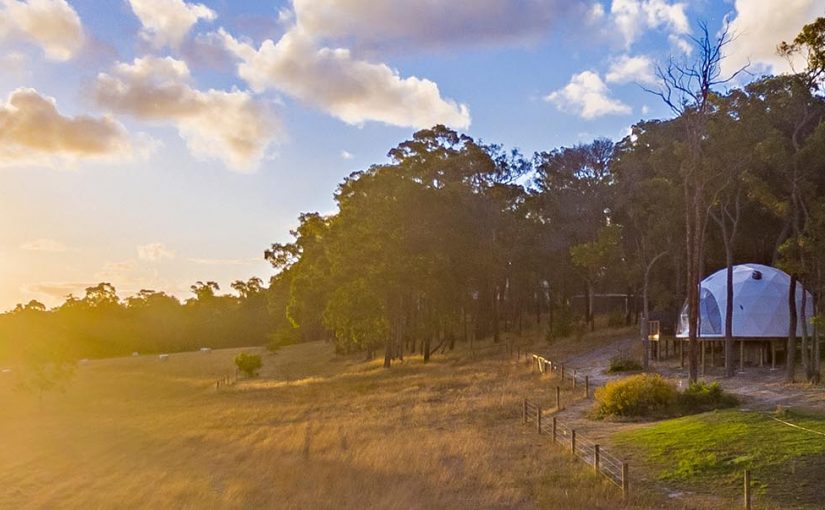
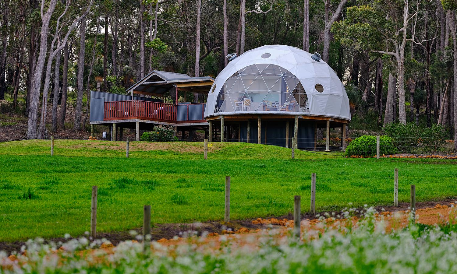
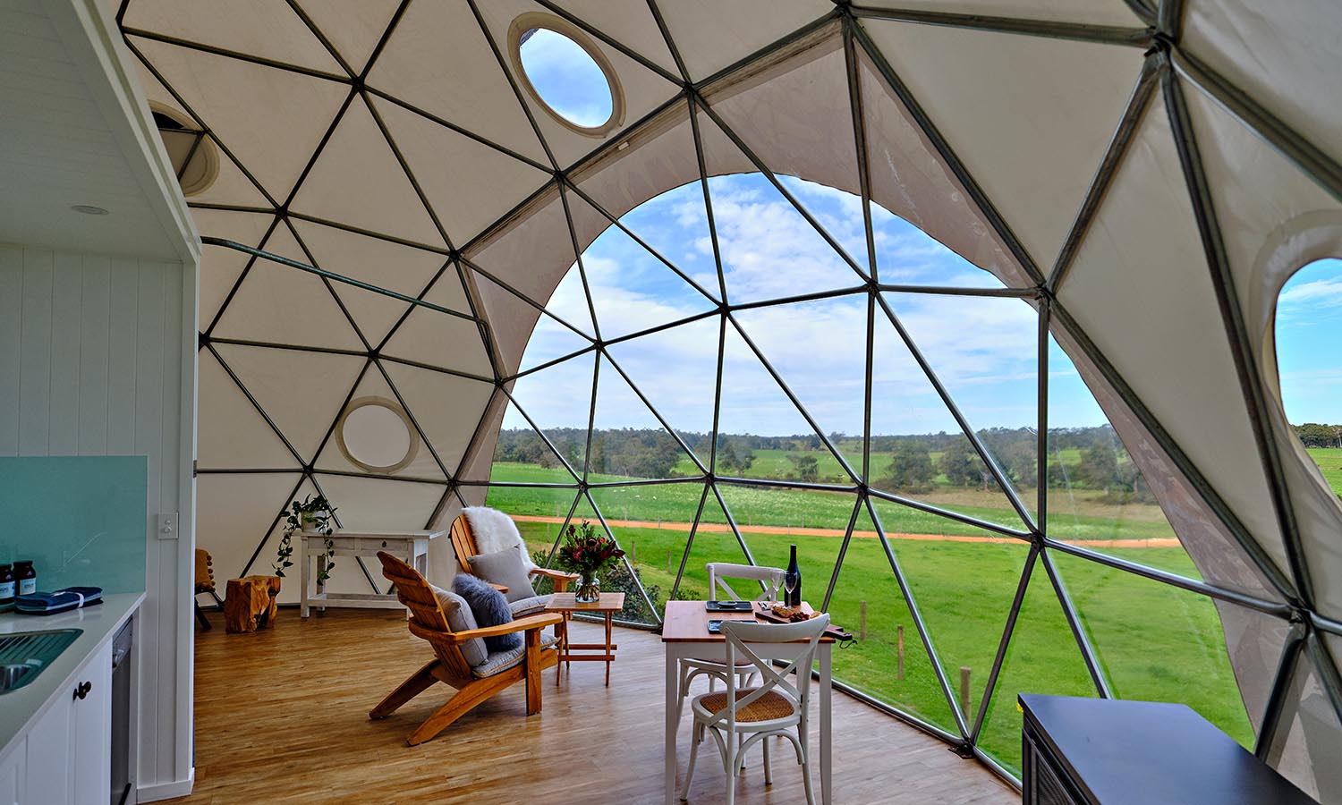
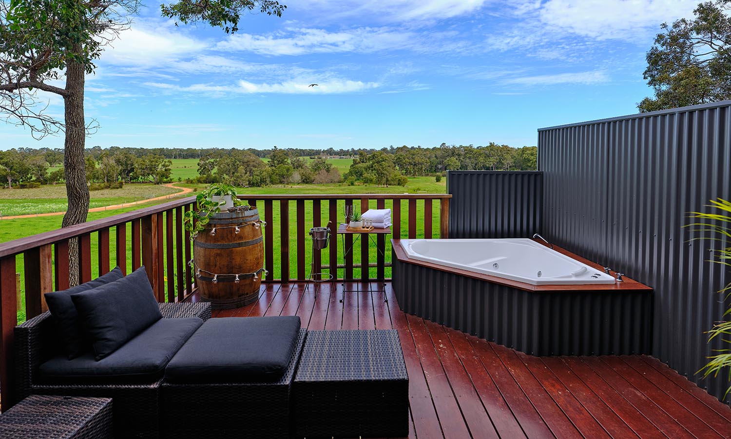
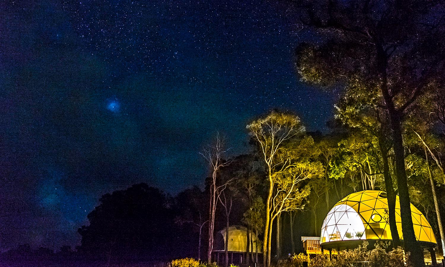
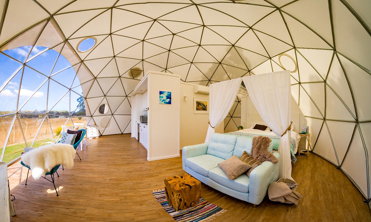
These futuristic pods set on the edge of a forest and overlooking farmland take camping up a notch. Apart from the spacious, light-filled interiors – there’s a four-poster bed, living space and kitchenette – each of the geodesic domes has its own barbecue area and two-person hot tub on the deck.
Wake to the view of kangaroos in the paddocks, then get exploring – the farm you’re staying on is located in the heart of the Margaret River region. Most people spend a bit of time tasting the area’s excellent wine and produce, but you’ll also discover craft breweries and some of the best surfing on the west coast.
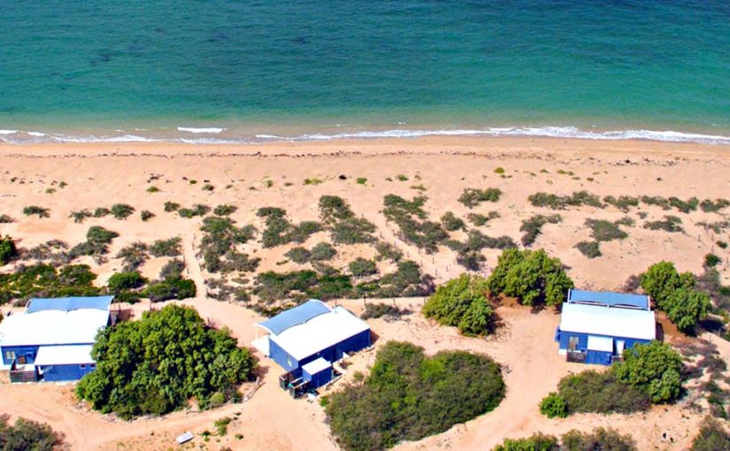
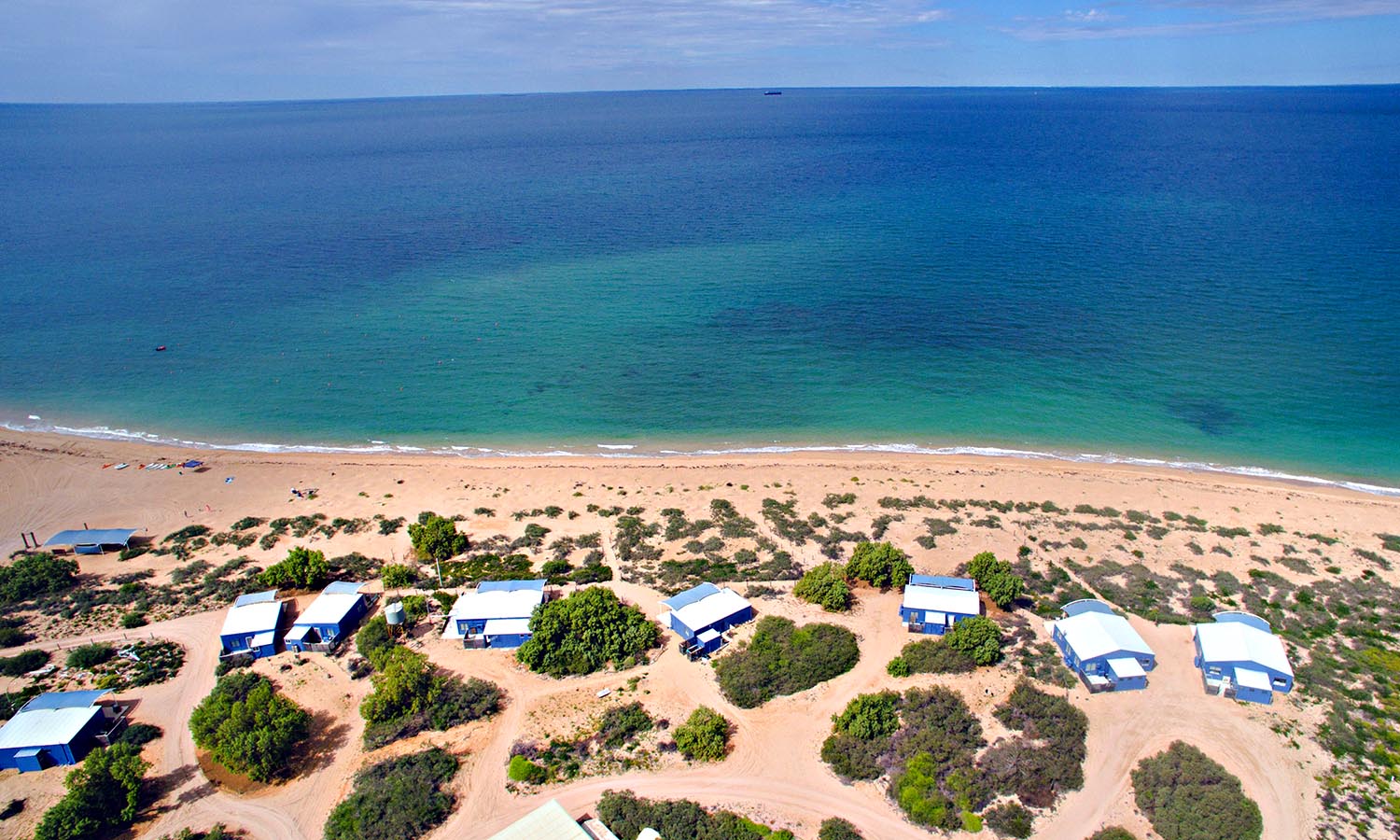
Set off the Pilbara coast in the Indian Ocean, Thevenard is the kind of spot you dream about being washed up on for a few days. If you enjoy the simple life with an epic setting, this is just the ticket. Ten absolute beachfront cabins are set overlooking the ocean and moored boats. It’s much loved by those who rejoice in throwing out a line, but you can also hire kayaks, SUPs and snorkelling gear to explore the fringing reef.
A casual dinner under the stars happens twice a week, otherwise guests fend for themselves. If you’ve got your own boat, you can make the 45-minute journey from Onslow yourself, otherwise there’s a twice-weekly transfer.
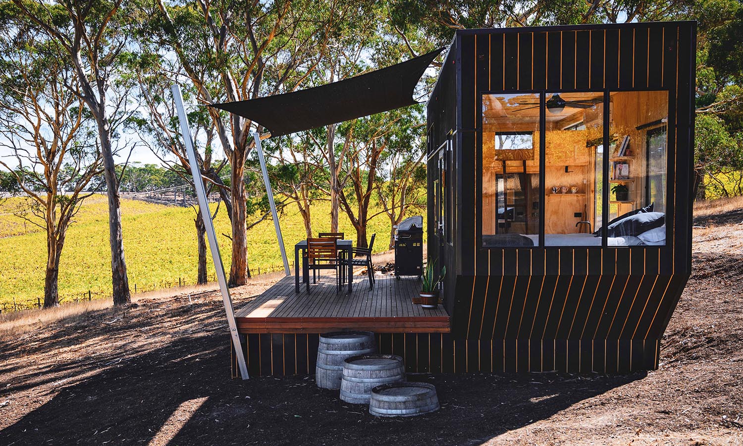
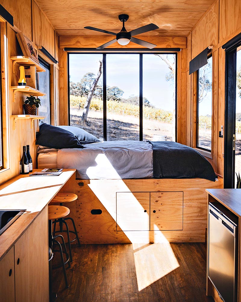
Kick back in the country and get a taste of tiny living with this cute little cabin, named Matilda. It’s the perfect getaway for anyone wanting to explore the wineries of McLaren Vale or the beaches of the Fleurieu Peninsula. She might be tiny, but four guests can sleep here (there are two queen beds – one’s in the loft) and enjoy everything the surrounding landscape has to offer.
Organise to go horse riding, hike in the nearby Kuitpo Forest, get out the binoculars for some birdwatching or assign a designated driver and hit the cellar doors. Pick up a book, play a board game, sit in the sunlight, take your dog for a walk (on-leash). Cabn is the perfect spot for a digital detox…have a conversation with a human, read a book, listen to music, and pour a glass of your favourite drop and settle in for the evening. Oh, and Matilda has four sisters in SA, all within easy driving of Adelaide.
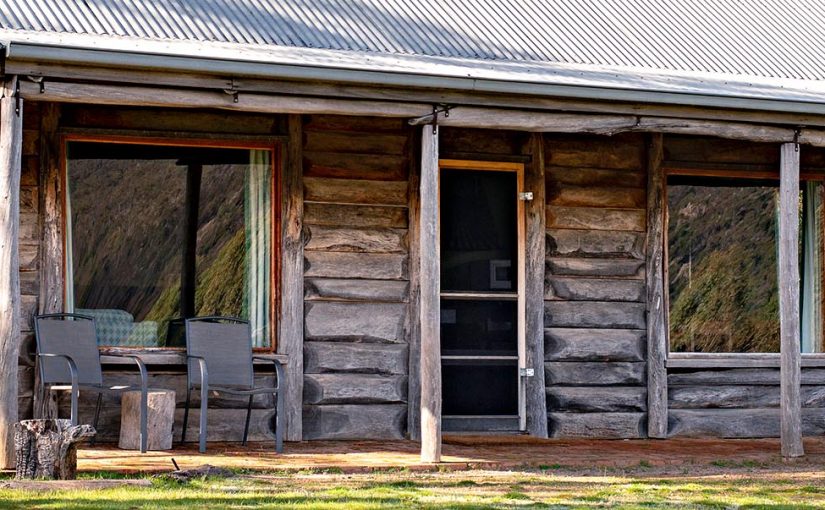
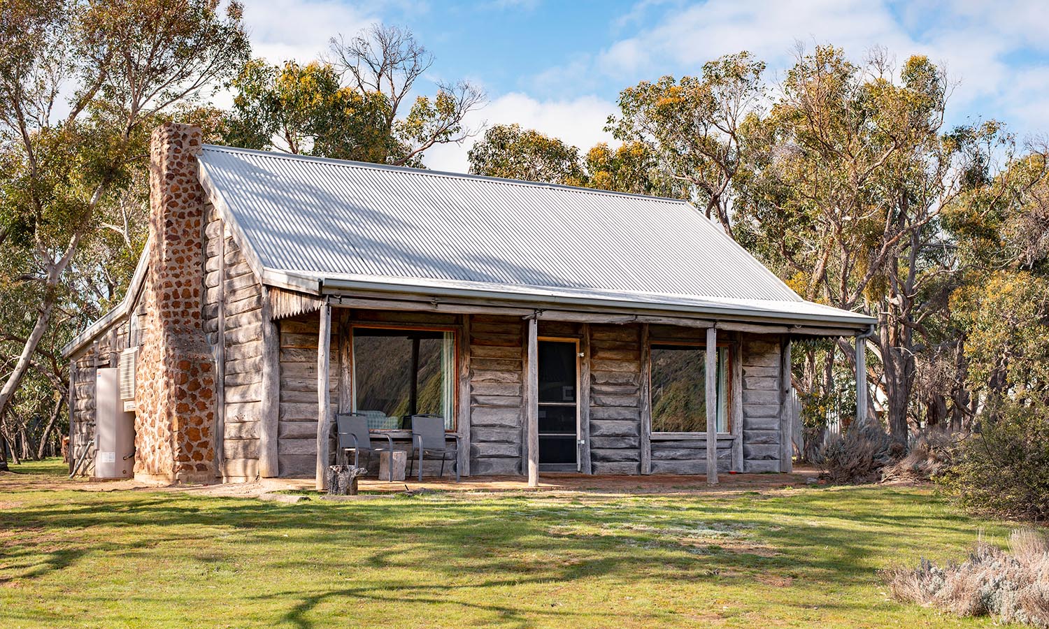
If you’ve never been to this part of Victoria you’re missing out. Halls Gap is at the base of the Grampians and the collection of four cottages at Grampians Pioneer Cottages has outstanding views of the mountains. Each was hand built by the property’s former owner using recycled building materials and filled with furnishings linked to the area’s history.
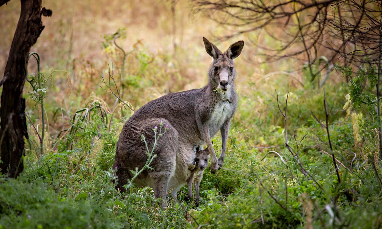
The smallest, the Redgum Log Cottage has two bedrooms and sleeps up to six, while the others have three bedrooms and sleep eight. There’s kangaroos and emus to welcome you each morning. Gather some friends, stoke up the log fire and enjoy the tranquillity and local wildlife, or get out and about in nature on the national park’s hiking trails.
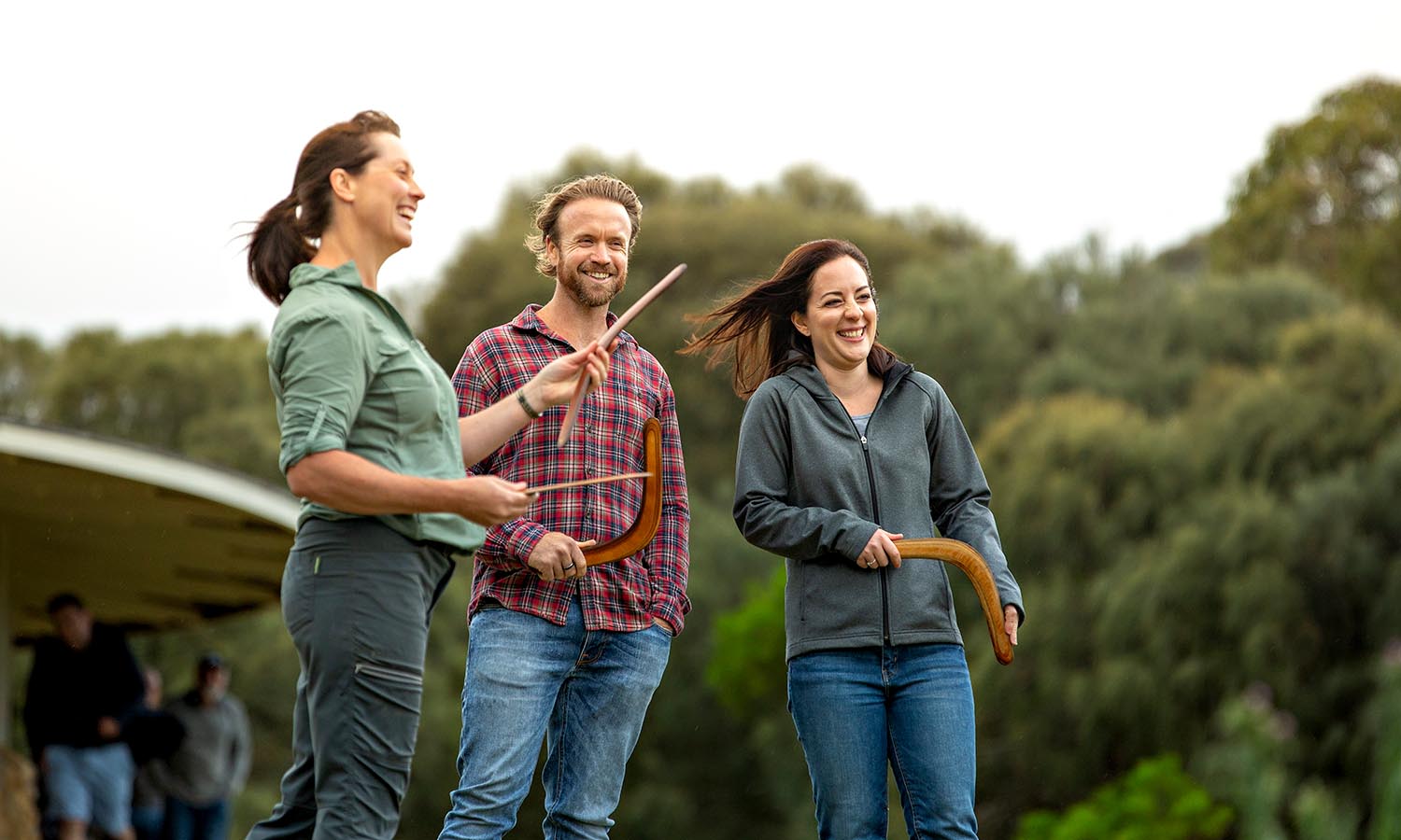
Experience the Australian bush, incredible landscapes and native animals with an Indigenous guide on the Worn Gundidj & Tower Hill tour.
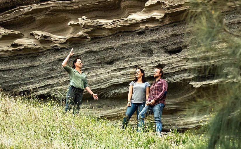
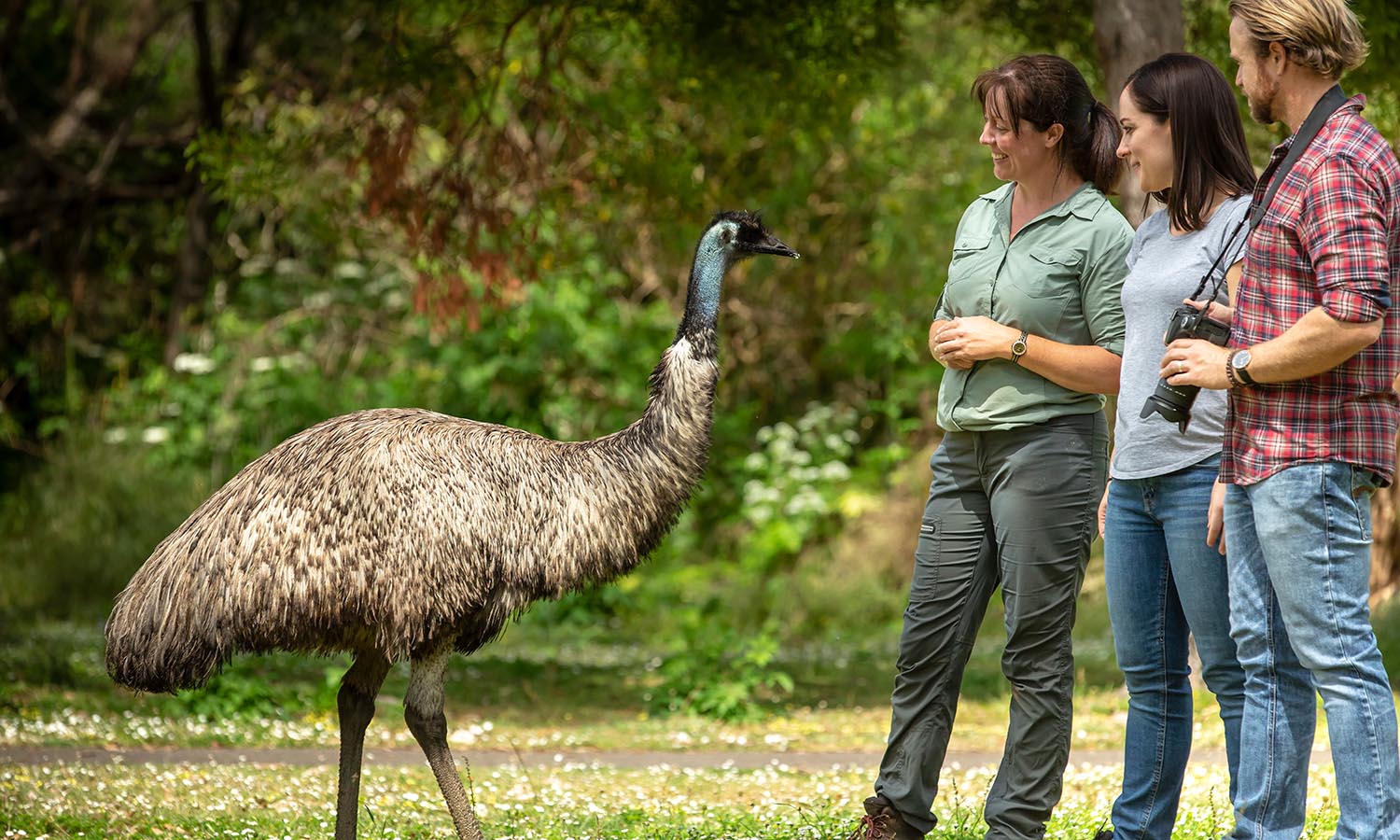
Tower Hill Wildlife Reserve in the heart of the spectacular Great Ocean Road region is the only wildlife reserve west of the popular Twelve Apostles. The reserve, near the town of Warrnambool sits inside a dormant volcano that has an 11-kilometer crater rim, with cones that rise from a lakebed in a formation created by a series of volcanic eruptions and events over thousands of years.
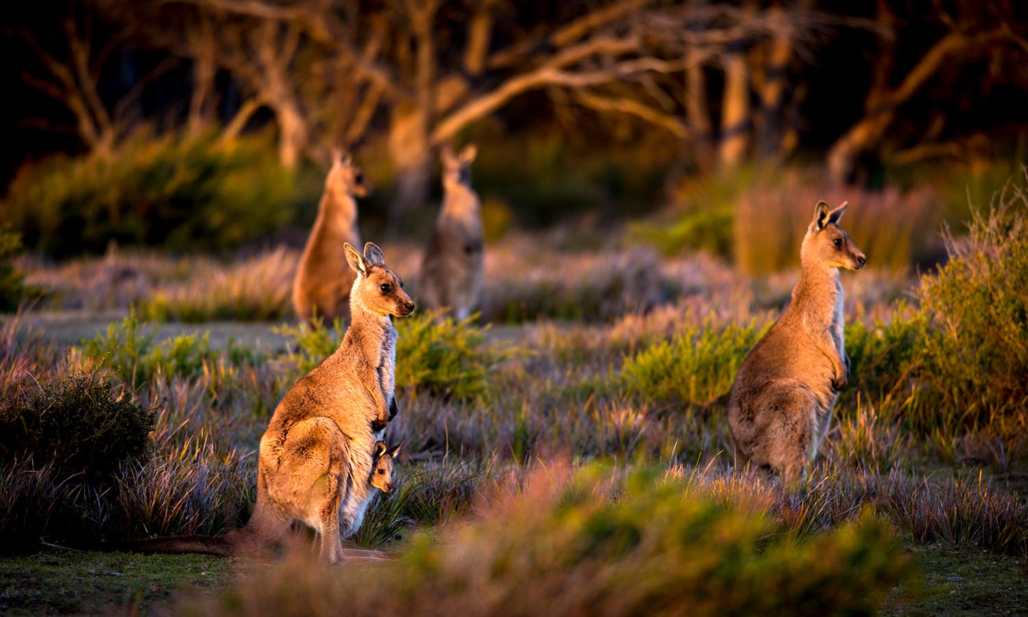
The area is now home to many of Australia’s native wildlife, giving visitors a rare opportunity to see animals including emus, koalas, kangaroos, echidnas, possums and sugar gliders and wedge-tail eagles up close.
A visit to Tower Hill, a major natural landmark on the Princes Highway, is a deep immersion in cultural history. Artefacts show Aboriginal people have lived in the area for at least 30,000 years, back to the days when violent volcanic explosions reshaped the landscape.
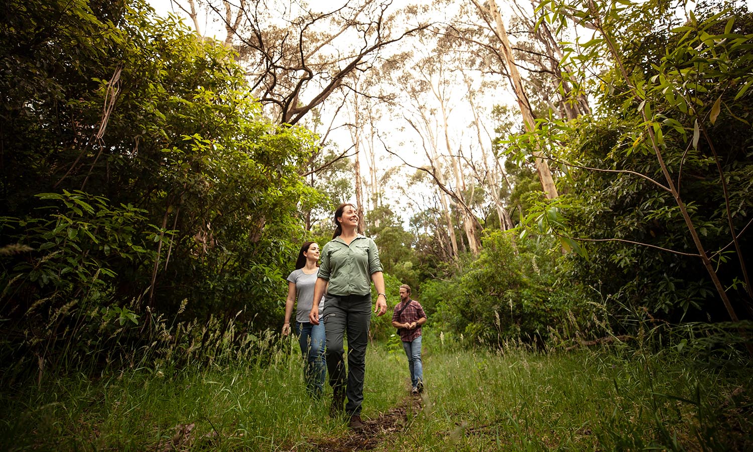
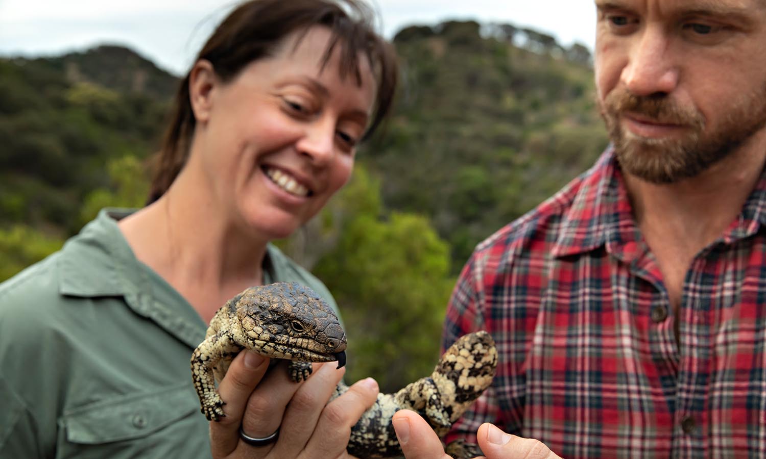
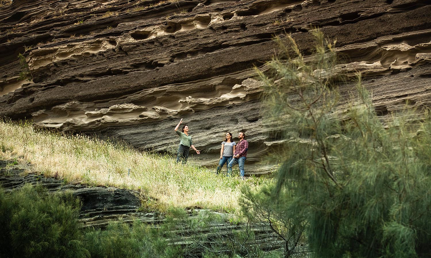
Today, the local Aboriginal cooperative, WG Enterprises, organise walking tours that offer an insight to Aboriginal culture. The 90-minute walking tours, led by members of the Gunditjmara Nation, offer visitors the opportunity to learn about the area’s histories, its geology, and Aboriginal era and European settlement. Walks are personalised to interests and may examine artefacts from axe handles, to possum cloaks, didgeridoo performances, and foraging for local bush foods.
Visitors will gain an understanding of traditional Aboriginal lifestyles and learn how to identify native plants for food and medicine. On the evening walk, explore bush tucker, and as night closes in, see some of the nocturnal animals that hide during the day.
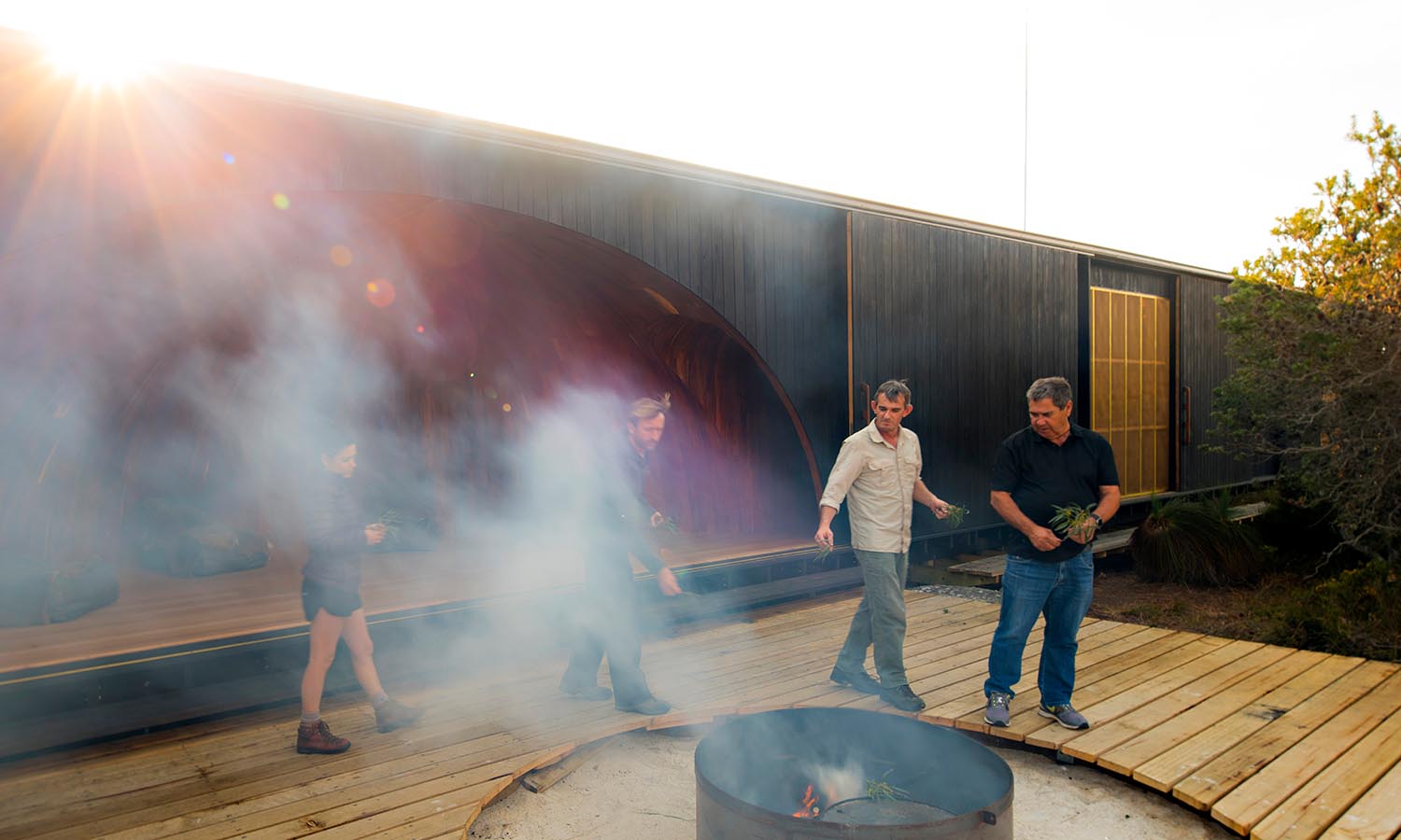
A pioneering hike guided by the palawa Indigenous community offers a deeper, nuanced perspective on Tasmania, Australia’s island state.
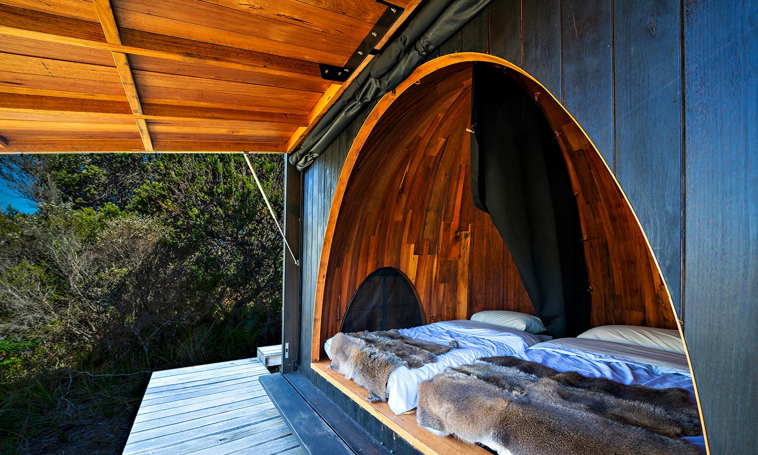
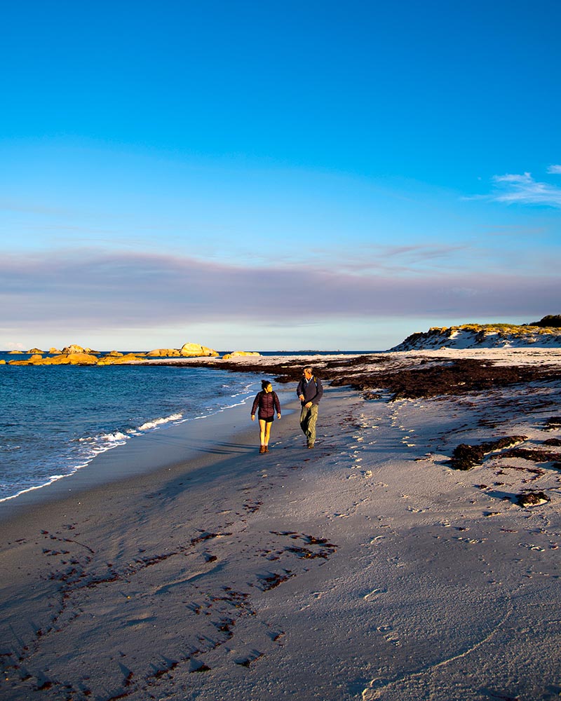
The wukalina Walk is a three night, four day Aboriginal guided coastal walk based around the stunning natural landscape of the larapuna (Bay of Fires) and wukalina (Mt William) areas in North East Tasmania, the cultural homeland of the palawa. The palawa are the only group of humans to evolve in isolation for over 10,000 years, so their culture and heritage is distinctively different from Australia’s mainland Aboriginal cultures, both in traditional times and since European occupation.
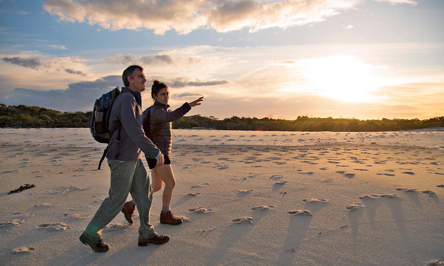
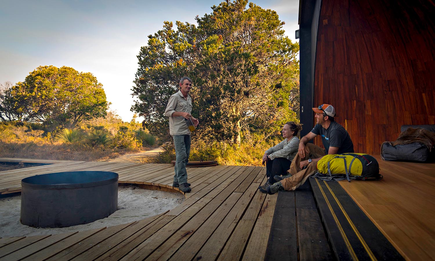
While traversing national parkland and reserve landscapes across larapuna (Bay of Fires) and the rugged beauty of wukalina and larapuna Bay of Fires, travellers will spend two nights in bespoke palawa inspired (domed) huts and one night in the Lighthouse Keepers Cottage at larapuna/Bay of Fires. Guests will be immersed in palawa culture and community and participate in cultural practices that have been handed down for hundreds of generations.
The experience provides a rare opportunity to walk with palawa guides in the footsteps of their traditional people. Guests sit in a semicircle around a campfire, listening to stories and learning ancient crafts. The palawa people did not document their history in books nor was it kept in museums, their tradition was an oral one and the landscape is their museum.
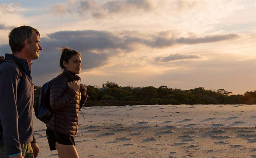
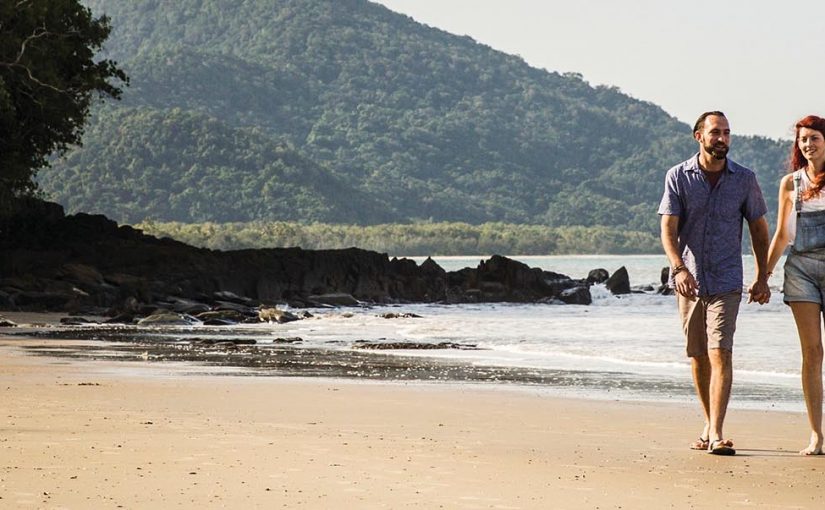
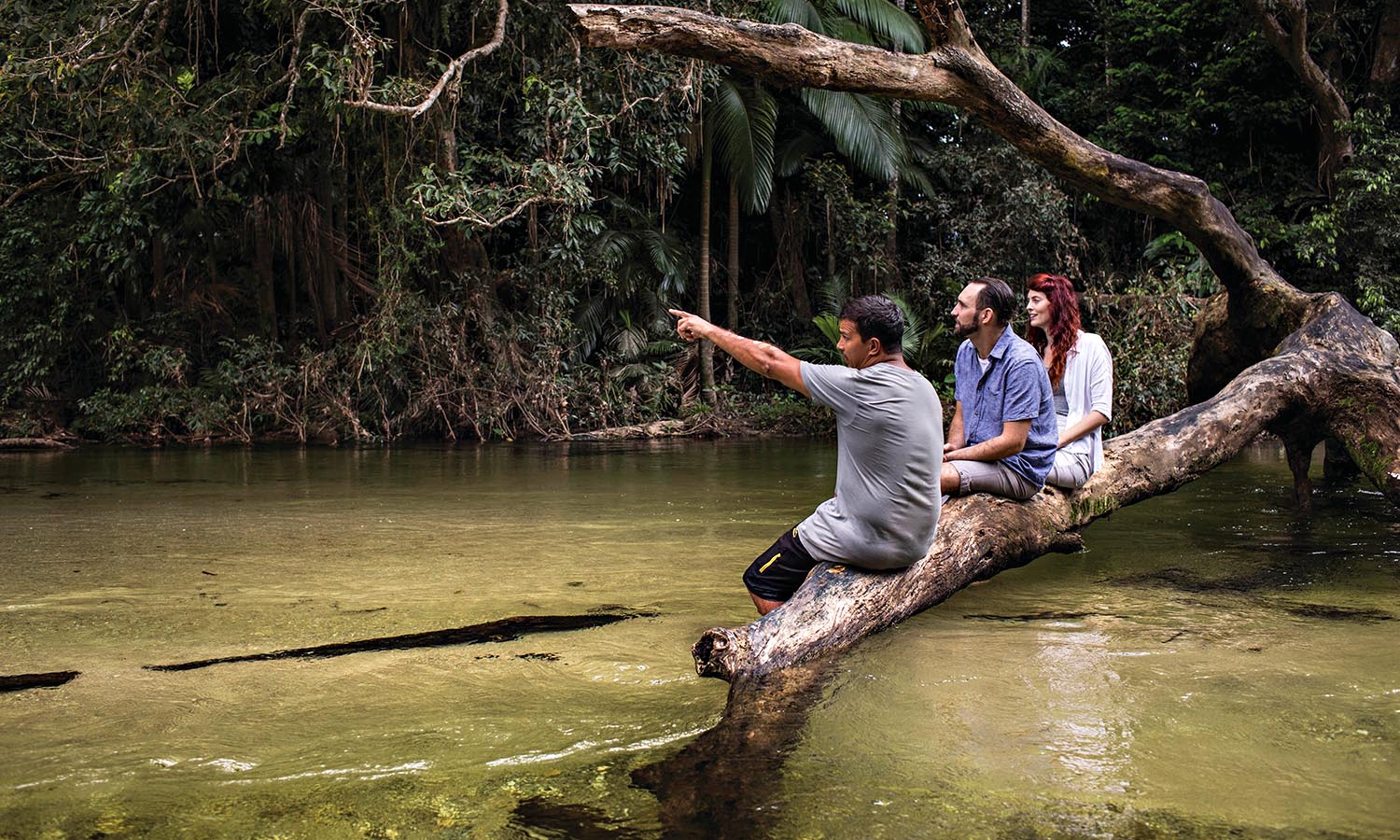
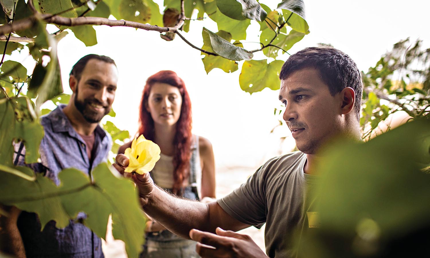
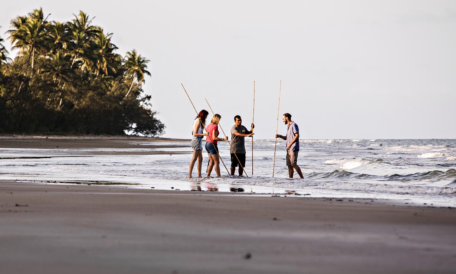
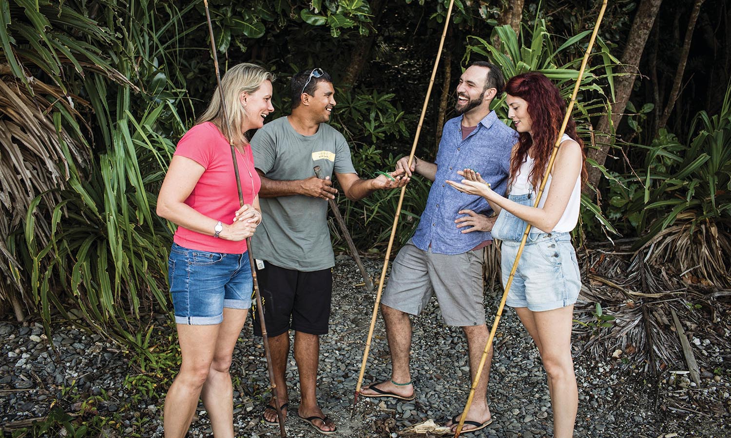
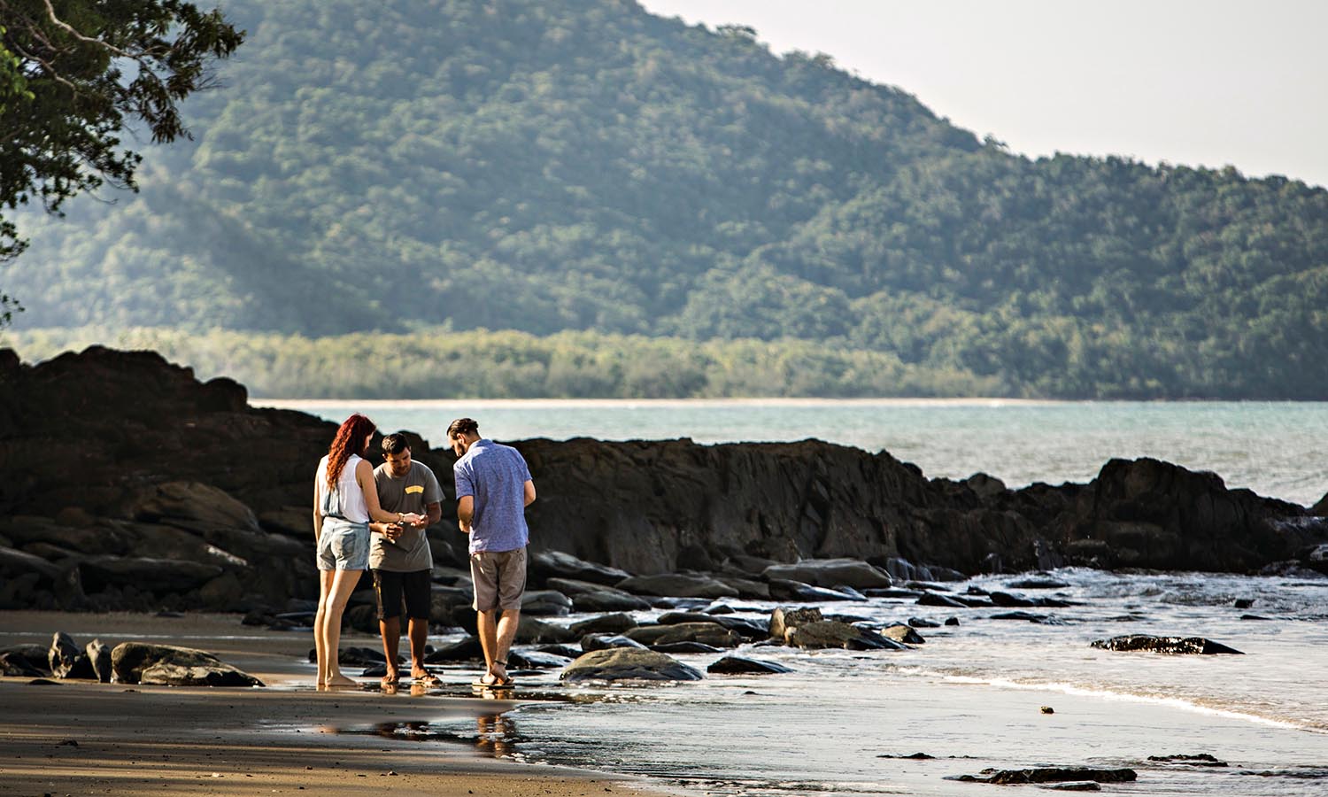
Explore the beauty of the Daintree Rainforest, with a local Aboriginal guide on Walkabout Cultural Adventures.
There is no better way to experience the region, one of the best biologically diverse rainforests in the world, and only place where two natural World Heritage sites meet – the Far North Queensland coastline and Great Barrier Reef meeting the edge of the Daintree Rainforest.
Your guides offer insight into the marine life along the beautiful coastline of the Port Douglas area and reveal local swimming spots in the rainforest. Juan, the owner is a Kuku Yalanji man from the Daintree Mossman area, with plenty of local bush knowledge and Aboriginal history to share. His aim is to preserve the knowledge and continue the connection between the people and the land by interacting with visitors and sharing the Kuku Yalanji history and cultural practises.
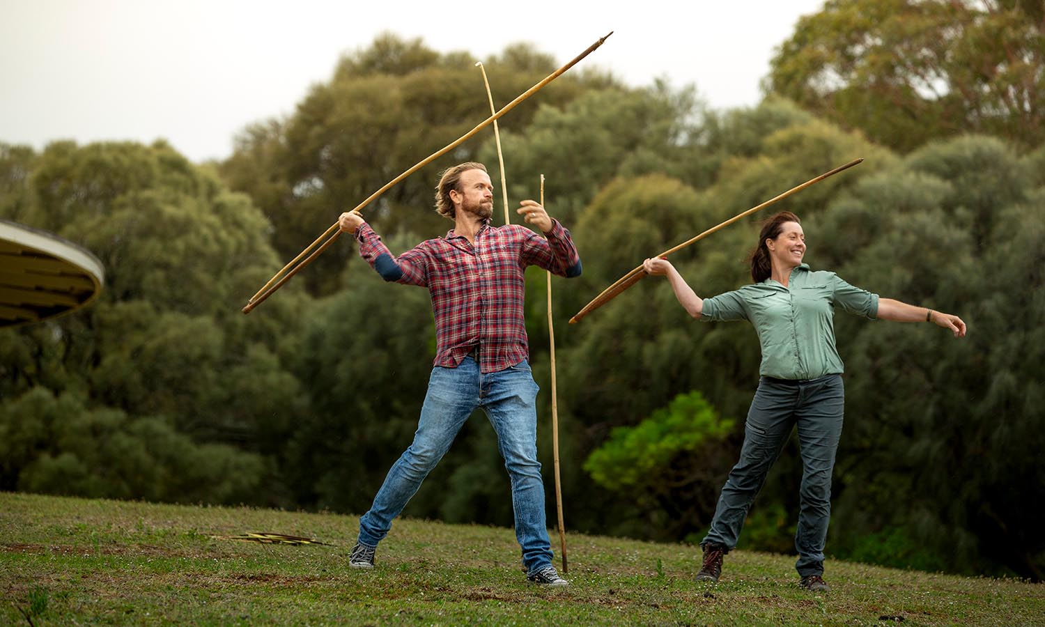
Experience the unique cultural connection to the land. Learn to throw a traditional fishing spear and have a taste of seasonal bush tucker, while seeing the best attractions on a half day or full day tour. The full day tour includes a guided rainforest walk, visit to Mossman Gorge and other culturally significant areas.
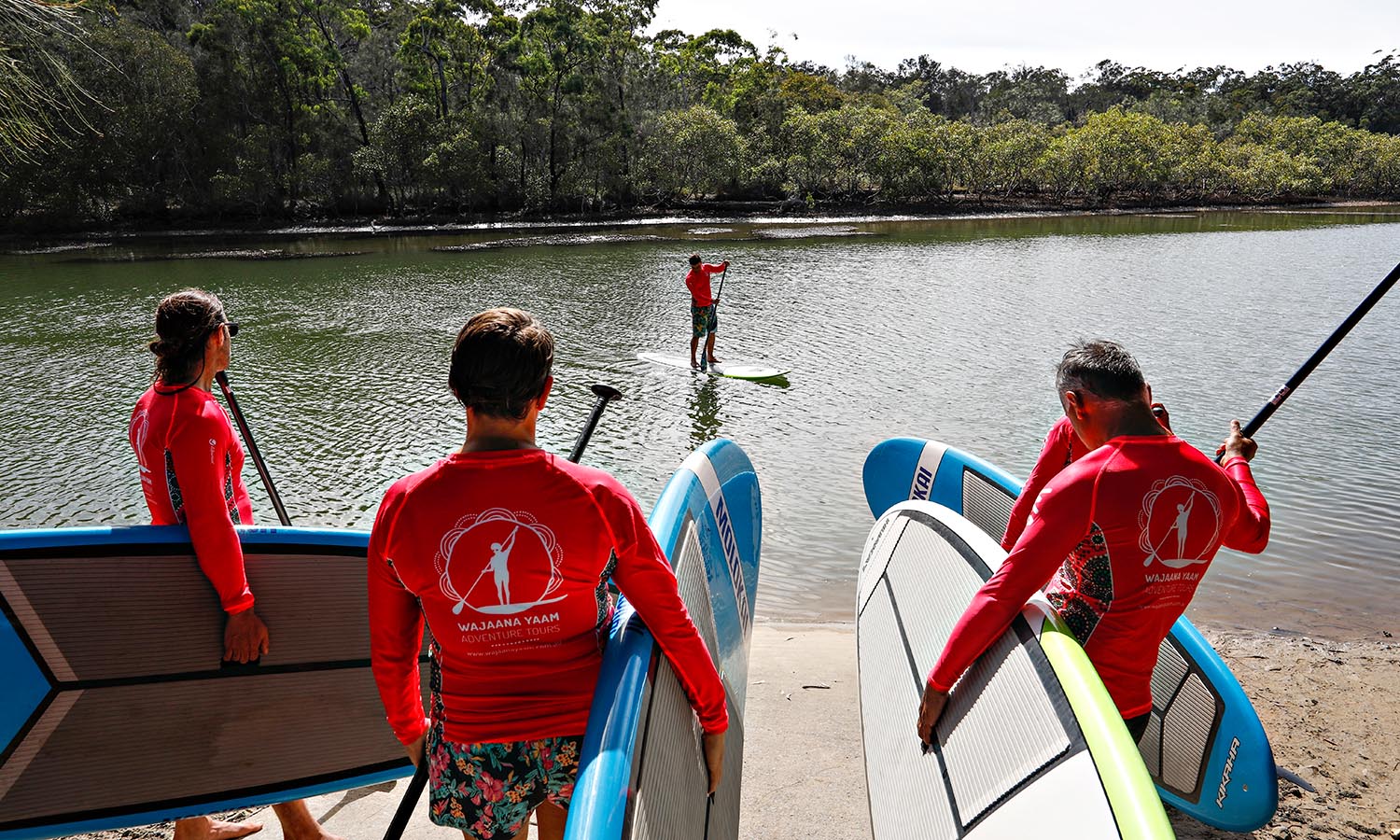
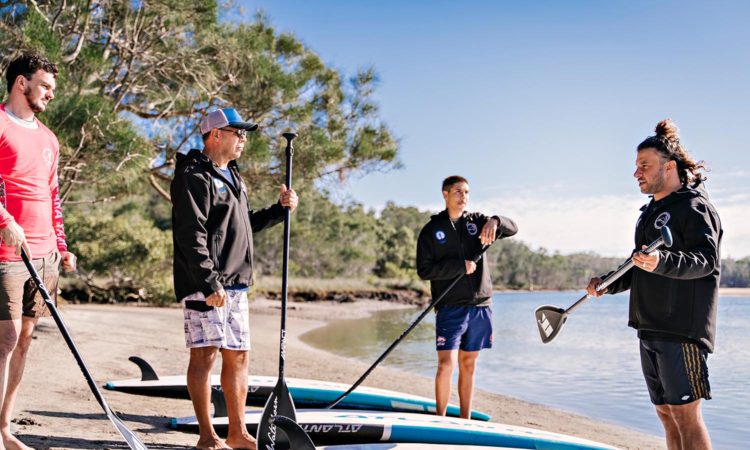
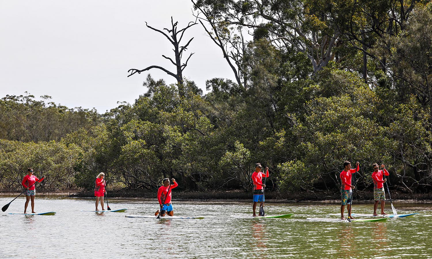
On Wajaana Yaam Adventure Tours, Gumbaynggirr/Bundjalung man Clark Webb and his fellow Aboriginal guides share ancient stories in the extraordinary natural landscape of Gumbaynggirr Country, on the New South Wales mid-North Coast.
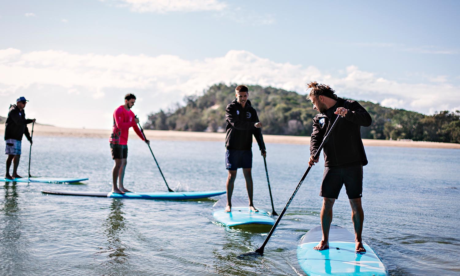
Stand-up paddle boarding or kayak through one of three Coffs Harbour’s Solitary Islands Marine Park adventure tour locations (the Moonee, Coffs and Red Rock Creeks). Guest will paddle with direct descendants of the world’s first stand up paddlers and connect to land and sea through stories and language.
Visitors can jump aboard a full-day tour, which pairs a paddle with the Giingan Gumbaynggirr Cultural Experience. The cultural offering is a walking tour through Orara East State Forest, with stunning views from the Forest Sky Pier and an opportunity to feel a deeper connection to the land. This tour takes place at an important cultural site of the Gumbaynggirr people with guides sharing intimate stories, songs and language and imparting their knowledge on the use of native plants.
By taking part in the experience, guests are making a direct contribution to the revitalisation of Gumbaynggirr language and culture and contributing to the well-being of the community. Wajaana Yaam Adventure Tours work closely with the community and elders and this social enterprise provides an employment pathway for the youth and community through knowledge of language and culture.
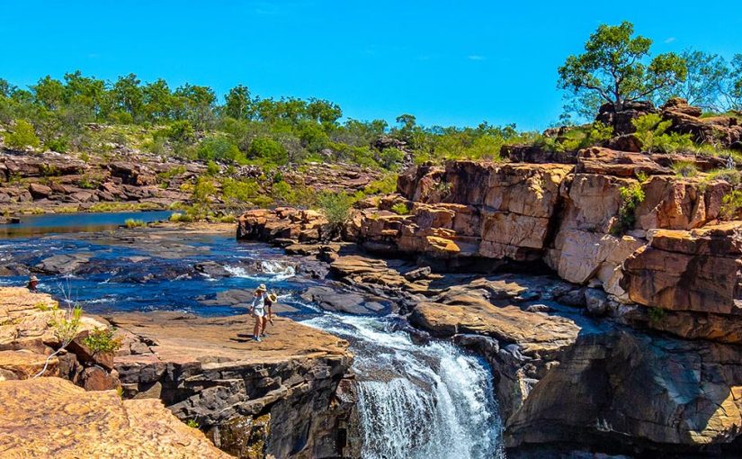
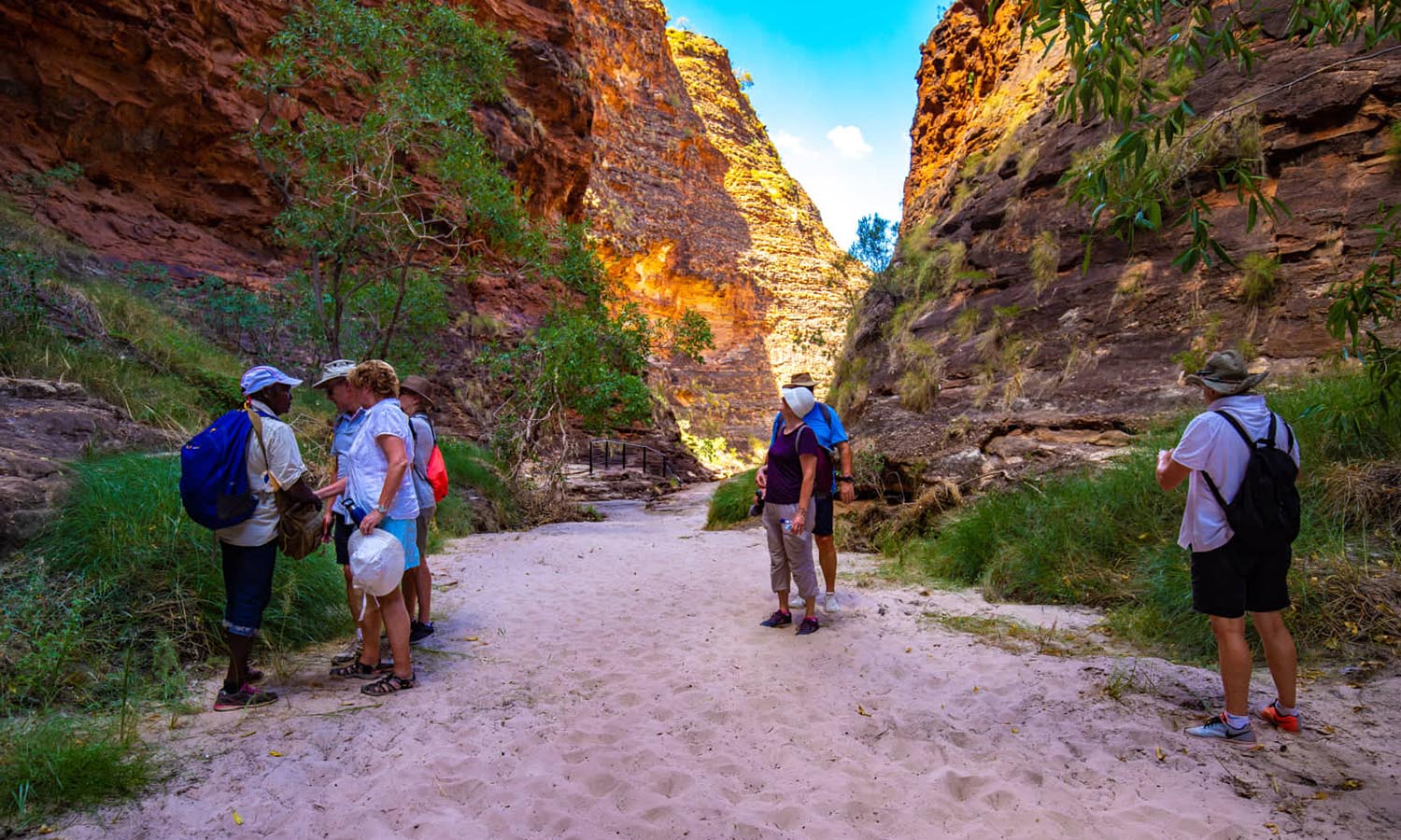
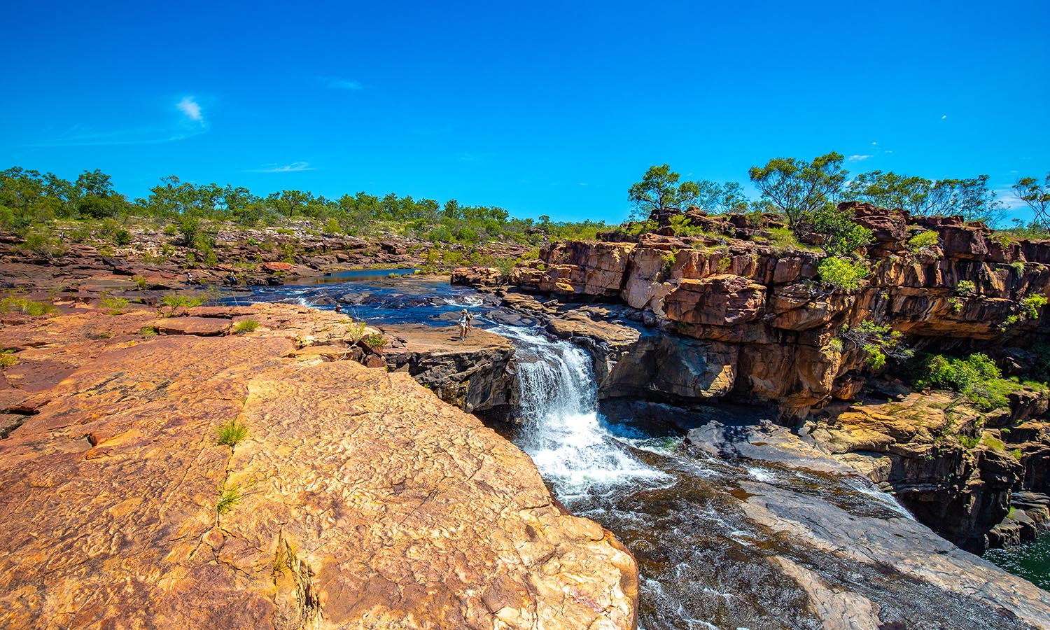
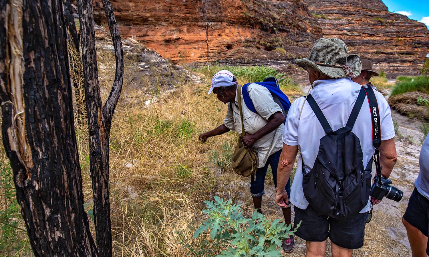
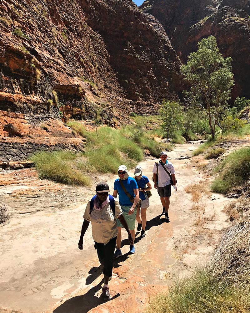
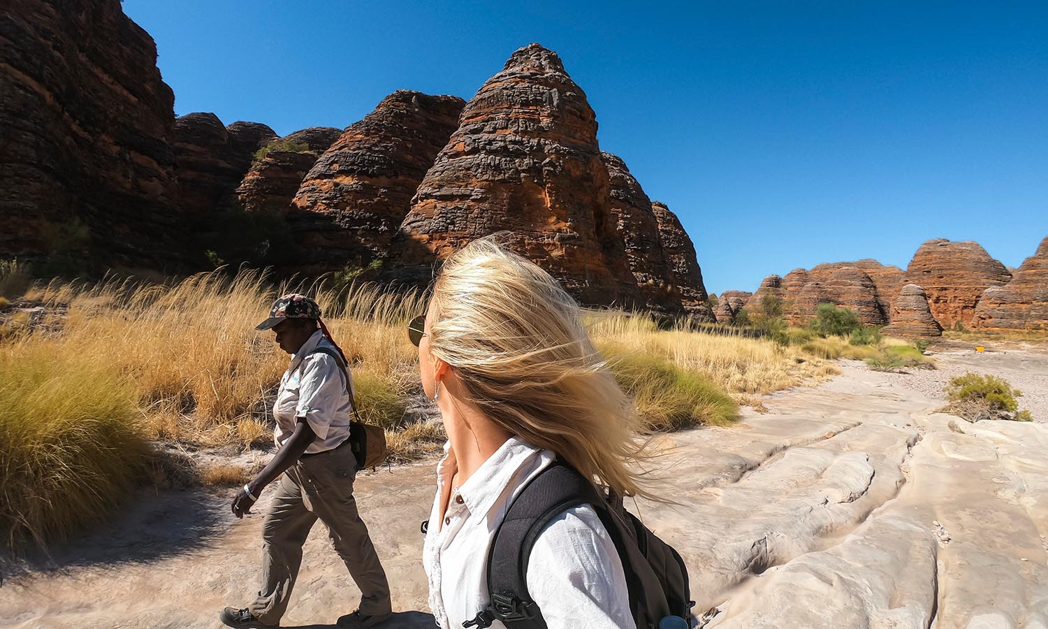
Explore remote, ancient landscapes in Western Australia with Kingfisher Tours, with one day and multi-day expeditions of the Kimberley region with local Aboriginal guides.
Travellers can fly over the Bungle Bungles, walk in a World-Heritage listed landscape and visit remote communities with guides, who share stories of friends and families, and impart cultural knowledge. Learn about bush medicine, native plant identification, and be immersed in Indigenous storytelling by the Traditional Owners of these lands.
One of the most stunning tours is a Bungles Day Trek, flying over Lake Kununurra, Lake Argyle and the Osmond Ranges, and a Welcome to Country ceremony by a local Aboriginal guide. Visitors walk up the Echidna lookout, and hear stories of native animals, and then explore the spectacular chasm.
Guides sing traditional songs of the gorges that are thousands of years old and explain the cultural and geological history of the area. The stunning dome-like rock formations are estimated to be around 350 million years old. Aboriginal people have inhabited the area for 40,000 years and bring this stunning UNESCO Natural World Heritage site to life.
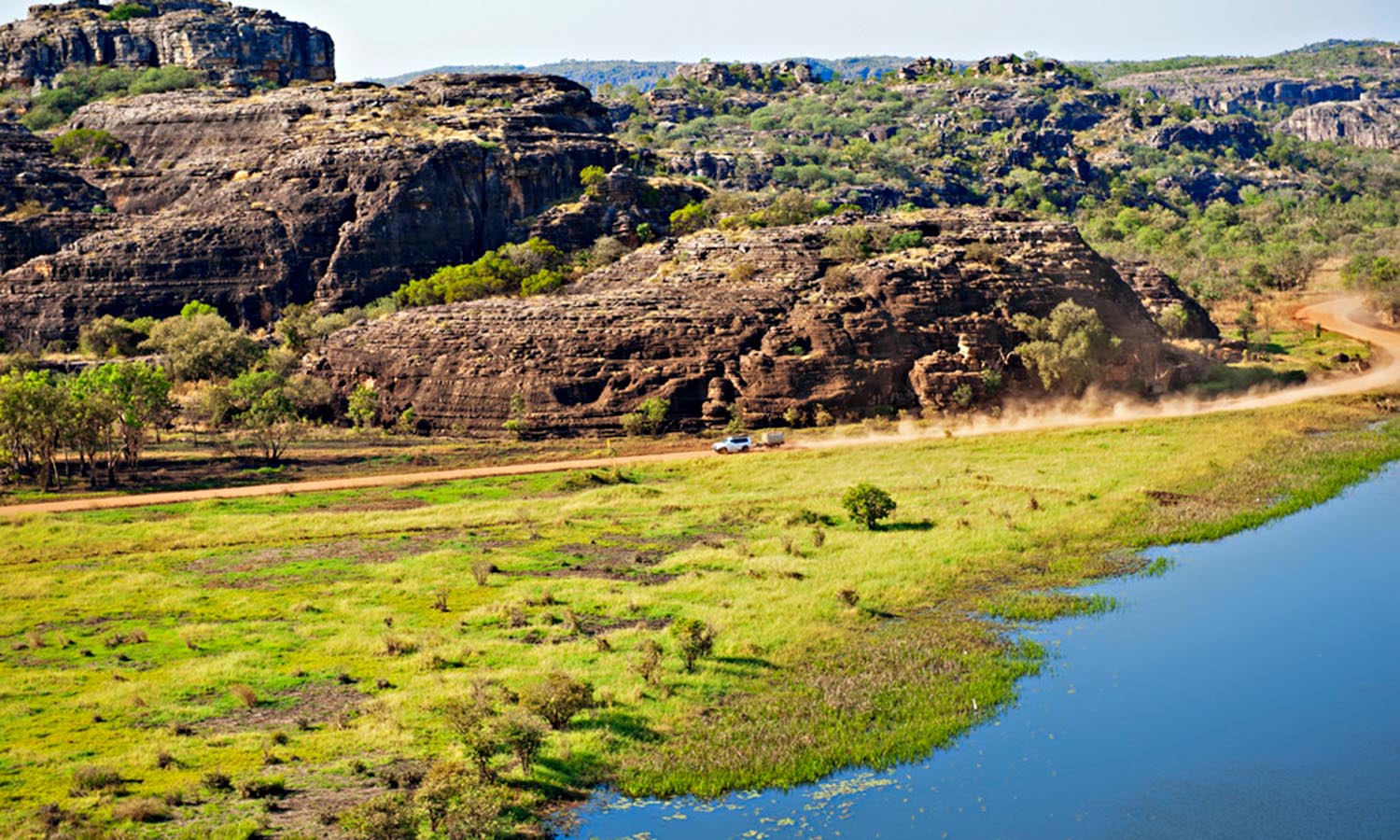
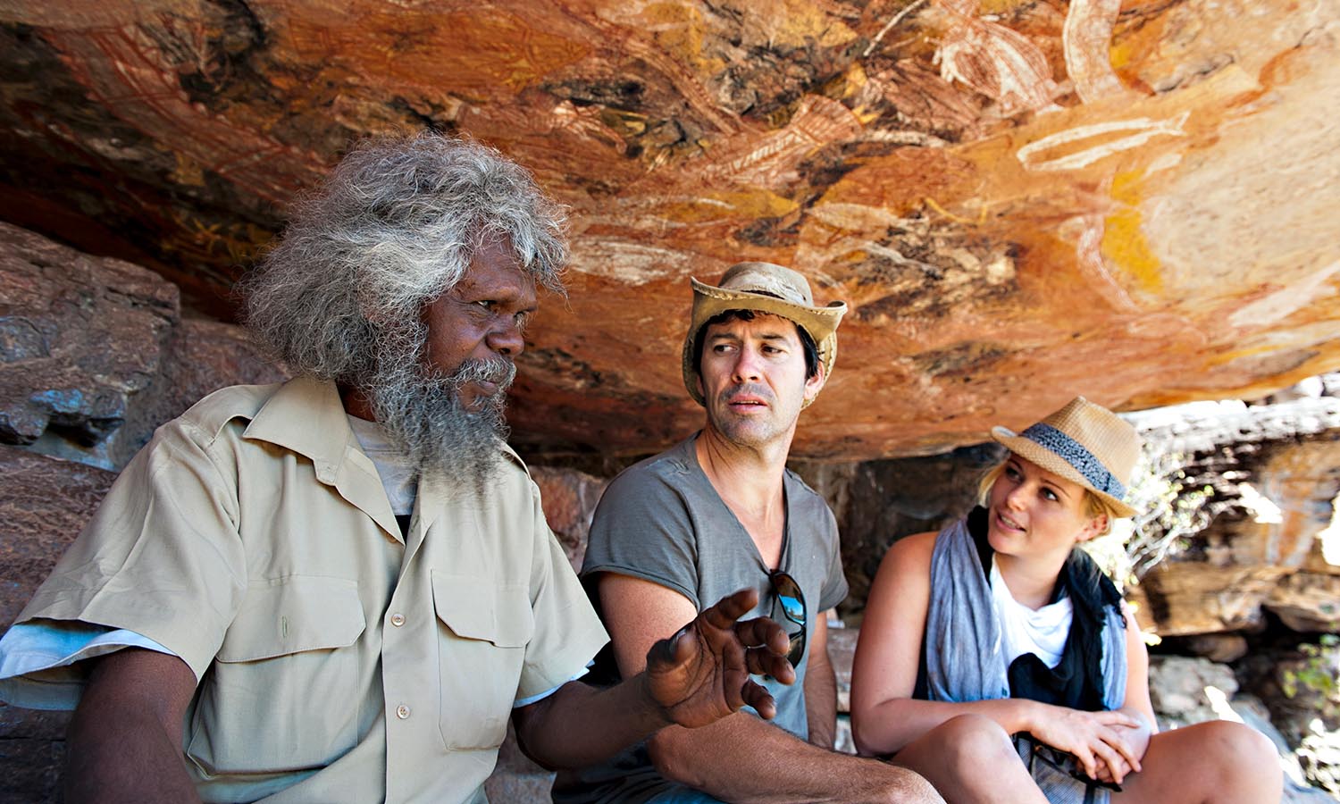
Explore Arnhem Land, Kimberley region and Kakadu with one of the most recognised and respected guides in Australia – Sab Lord of Lords Kakadu & Arnhemland Safaris.
These Top End adventures allow the traveller a unique insight into Aboriginal culture, flora and fauna through the knowledge of traditional land owners. Sab and his expert guides host camping experiences at his permanent bush camp in Kakadu National Park. Or be one of the lucky one to join his accommodated safaris for private groups – he has permits to visit the beautiful Koolpin Gorge in Kakadu National Park, which few are fortunate enough to see.
Arnhem Land has always been Aboriginal land, and with permits having been required to enter since 1931, protection of Arnhem Land means that it has remained untouched and pristine. Sab works closely with other award-winning operators such as Bamurru Plains, Cicada Lodge and Davidson’s Arnhemland Safaris to ensure that all tours are of a high quality.
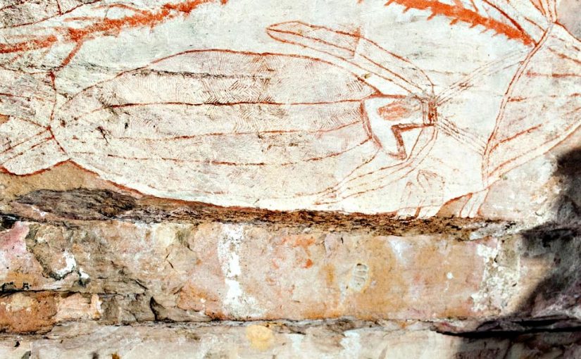
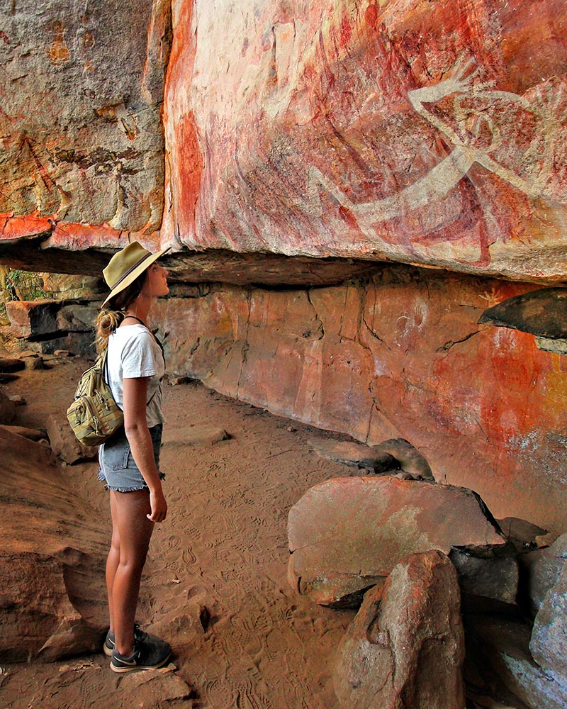
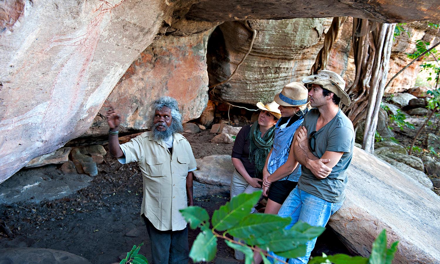
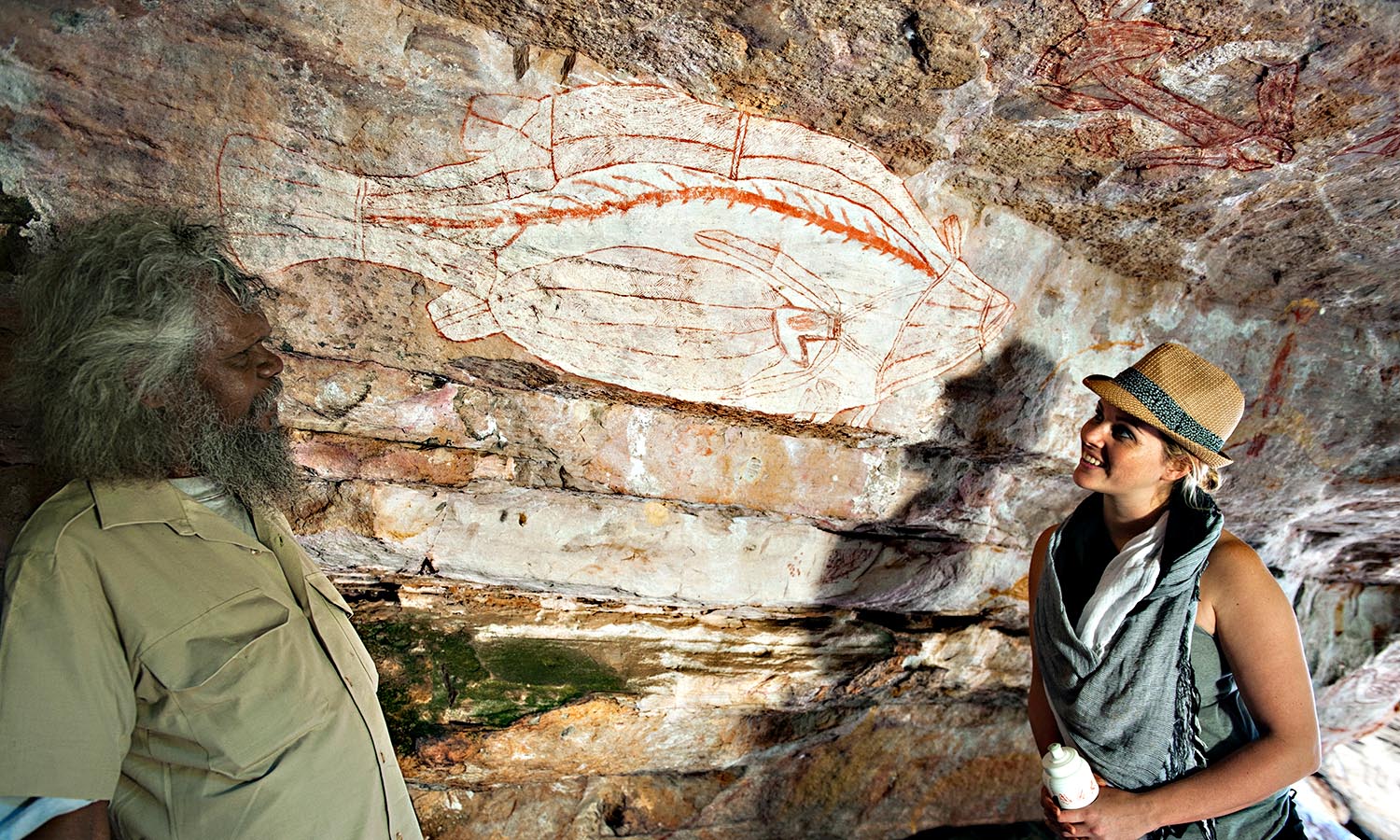
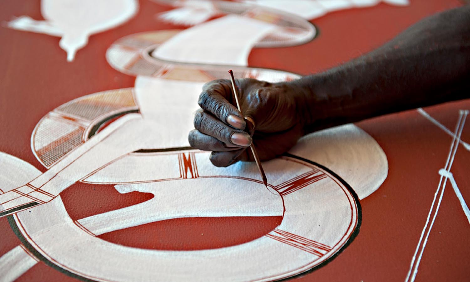
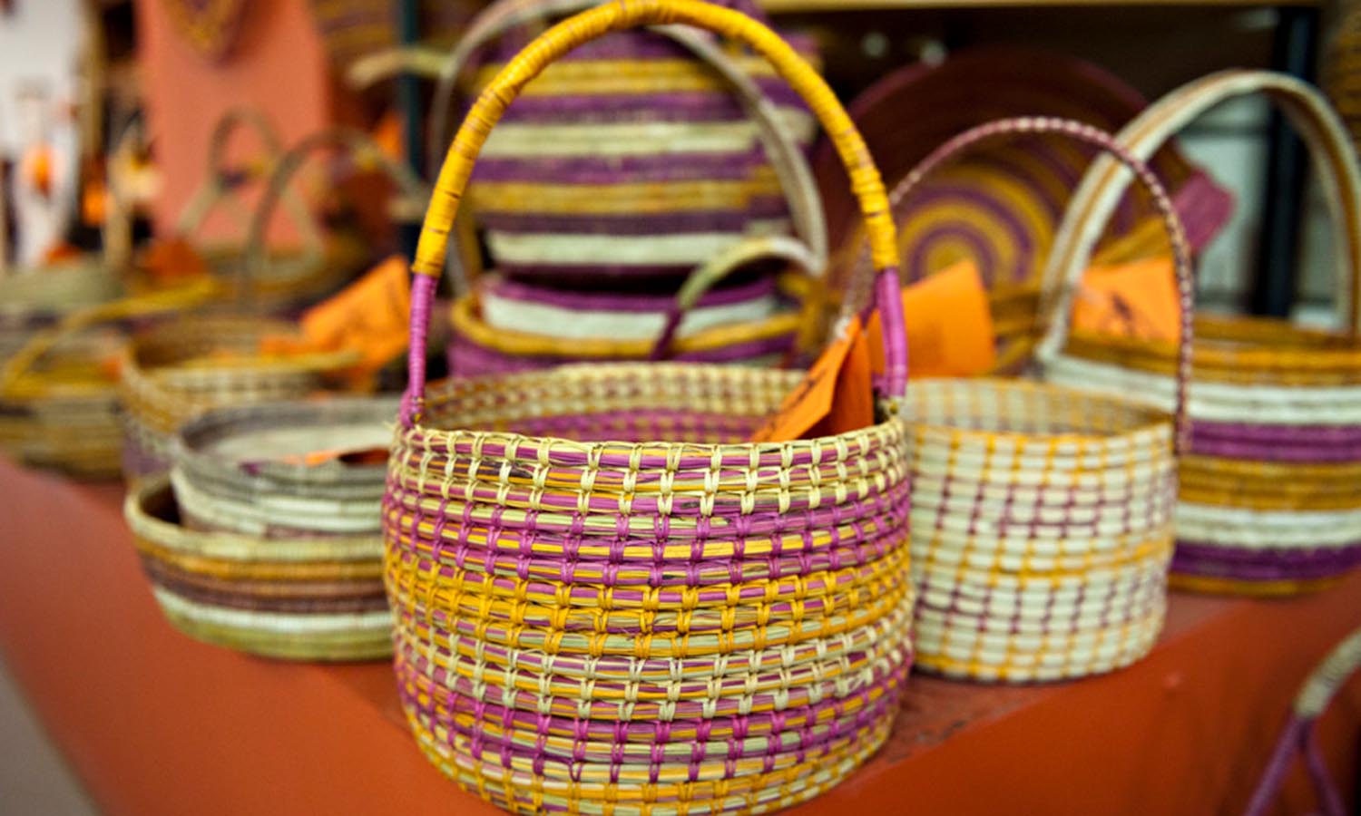
These tours offer privileged access to the entire area and can generally take guests anywhere they want to go across the region, matched to the guests’ interest. This includes photography enthusiasts who want to photograph birds, culture and landscape, as well as those who want to gain a deeper understanding of the Indigenous people of the region. The rock art at Injalak Hill in particular is a sight to see and local guides explain its significance that dates back to between 100 and 8,000 ago.
Sab and his small number of guides operate exclusive and personalised private tours through Kakadu and Arnhem Land during the dry season – April and October. Accommodation options range from world class luxury lodges to comfortable private camps, with permanent tents, with floors, beds and solar lights and fans. Who says you have to rough it in the Top End!
 (
(

